Country: Nigeria – City: Kano – Address: Department of Geography, Yusuf Maitama Sule Federal University of Education Kanohttps://www.geonight.net/25261-2/
Our World Our Environments Our Geography
see at the bottom of this page for the paper presented for the GeoNight
Programme of EventDescription:
The event will start with short walk with the students to create more awareness to the public and later to make public lecture about Geography and activities of Geographers
Main objectives:
This event aims to highlight geography and geographers, give the greater public a chance to familiarize themselves with geographic concepts and studies and to make geographical research more accessible. The proposed events should, whenever possible, be free and open to the public
Event language: English
The event will be: “Live” in presence
Reference person: Salisu Lawal Halliru PhD – Role or function: Secretary Association of Nigerian Geographers Kano Chapter – Reference organization: Department of Geography, Federal University of Education Kano
Those who organize are: Academics
Estimated starting time (local time): 10:00:00 AM
Expected duration: around 2 hours
Adamu Idris Tanko, PhD, FRGS, FANG
Professor of Geography
Paper Presented at the Geo Night (and Day) 2025, April 4, 2025 at Yusuf MaitamaSule Federal University of Education, Kano
Preamble
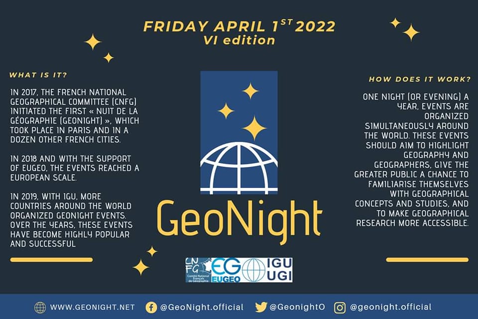
Today, being April 4, 2025 I am delighted to participate in this activity, which is the International Night (and Day) of Geography and promoted by EUGEO and the IGU. I learnt that The GeoNight began as an initiative of the French National Geographical Committee, and it was first celebrated at a National scale in 2017 in Paris. From 2018 onwards, the initiative has expanded internationally, first in Europe, thanks to EUGEO, and then even beyond, thanks to the IGU.
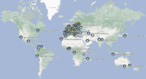
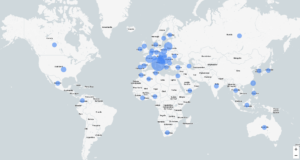
For this year, I am proud that we are gathered here as many other geographers around the world. The Map that I saw (as released by MassimilianoTabusi and Arturo Gallia) was impressive that the Night (and Day) is being celebrated all over Europe; in six countries each around Africa, and around Asia; three in Oceania; four in Latin America; and in three States of the United States of America. Each country has its theme, and going through a few of them is even more geographically impressive. Let me share some of them here: Venture into the Richness of Geography (Croatia);UniCarTo 2025: mappare la citta di Torino con ilpuntodivistadegli studentuniversitari (Italy); Women Geographers & Science (Spain); La geographie pour faire Societe (France); March of Geographers (Lithuania); Envisioning Landscapes (Italy); The role of geography in students life (Romania); etc. Indeed, it makes me even more proud as a Geographer. It is important for me to appreciate this gentleman Geographer Dr. Salisu Lawal Halliru who makes it possible for us to be part of this year’s celebration.
INTRODUCTION
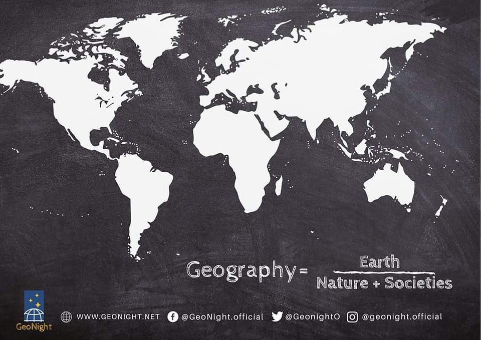
My presentation is titled: Geography and the Activities of Geographers. Of course the expectations are for me to talk about Geography but this time around, to non-geographers, and also for me to tell you what Geographers do. Of course, on the surface and to many non-geographers they may assume it is very simple. To them, Geography may simply be the study of the earth and its features, inhabitants and phenomena. They may expect me to tell them that the first person to use the word geography was Eratosthenes(276-194 B.C), and that the word “Geography” comes from two “Greek” words. ’Geo’, which means the earth, and then ‘graphy’ meaning“the study of”.No doubt if I say this it surely may make some sense, especially if the person is aware that the earth refers to the atmosphere,hydrosphere,lithosphere and biosphere. In which case, this means the discipline of Geography is the study of the place, localization and distribution of all these phenomena – atmosphere, hydrosphere, lithosphere and biosphere.”A description of these earth-bound phenomena is Geography.
To many Geographers that are here, if I should stop only on these, they will surely say that the explanation is not complete. Many would want me to explain further “how about the people?”, they will ask.In Geography, it is our concern,too, to explain the distribution and concentration of people, the nature of space and the time factor. In other words, it is significant to make the note that Geography is that part of the mixed mathematics which explains the state of the earth and of its parts depending on quantity namely,its figure,place,magnitude and motion. To study all these may not be easy. But I want my talk to be comprehensible. I can then begin to break Geography. It is a study that can be achieved by breaking it into two major branches – Physical and Human, but some geographers include Regional Geography as another Branch.
GEOGRAPHY – ITS BRANCHES
Physical Geography:Physical geography is concerned with the study of the description of nature or physical phenomena. It incorporates studying the planet and its systems.It covers the systematic sciences of geology/geomorphology,hydrology, weather/climate/meteorology,astronomy,botany,zoology and chemistry.
Human Geography: Human geography is a branch of geography that focuses on the study of how human activity affects the Earth’s surface. It focuses on patterns and processes that shape human interaction with various environments. It covers human, political, cultural, social, and economic aspects.
Regional Geography: Regional geography is the field of study that focuses on the relationships between various phenomena (which can be physical or human) within different regions, emphasizing the uniqueness and specificity of each region rather than general rules or patterns observed globally. Attention of Regional geographers is basically on the collection of descriptive information about places, as well as the proper methods for dividing the earth up into regions.
Importance of Geography
Geography is about connections of humans with spaces and places. Physical properties of the earth, such as mountain ranges and bodies of water, for example, can impact the way humans move, think, and act. Geography seeks to understand how physical landscapes shape human history and activities and decisions. Geography can help us understand the planet’s movement, changes, and systems. Those who know geography well much easier understand topics that are relevant to today such as climate change, water availability, natural resources, and more. As Human geography is an important part of geography, knowing the relationships between cultures, and why they exist at all is vital in our increasingly global world. Below are 21 points why geography is important:
- To understand basic physical systems that affect everyday life (e.g. earth-sun relationships, water cycles, wind and ocean currents).
- To learn the location of places and the physical and cultural characteristics of those places in order to function more effectively in our increasingly interdependent world.
- To understand the geography of past times and how geography has played important roles in the evolution of people, their ideas, places and environments.
- To develop a mental map of your community, province or territory, country and the world so that you can understand the “where” of places and events.
- To explain how the processes of human and physical systems have arranged and sometimes changed the surface of the Earth.
- To understand the spatial organization of society and see order in what often appears to be random scattering of people and places.
- To recognize spatial distributions at all scales – local and worldwide – in order to understand the complex connectivity of people and places.
- To be able to make sensible judgements about matters involving relationships between the physical environment and society.
- To appreciate Earth as the homeland of humankind and provide insight for wise management decisions about how the planet’s resources should be used.
- To understand global interdependence and to become a better global citizen.
- Studying geography helps us to have an awareness of a place. All places and spaces have a history behind them, shaped by humans, earth, and climate. Studying geography gives a meaning and awareness to places and spaces. It also helps students with spatial awareness on the globe. Understanding direction and where things are in the world is still a vital skill, despite having easy access to this information online.
- A Global Community: When a child or adult studies geography, they are further on their way to becoming a global citizen. Those who understand geography and how it has made the world the way it is today have a higher likelihood of understanding our global interdependence. They are more likely to participate in the global community.
- Nonfiction Reading Skills: For students of all ages, studying geography helps to develop nonfiction reading skills — not only in the studying of maps, but also in the reading materials that are associated with geography. Geography often involves first-hand accounts, reading of research studies, and analysis of data sets.
- Learn The Course Of History: Geography puts history in context. It helps us see the why, when, and how of what happened in history. You’ll learn history better by learning geography.
- Travel Smart: Study the geography of a place before you travel. Learn about its natural landscapes, cultures, and their influence on one another. This will not only help you plan a better travel experience for yourself, but you’ll make the most out of your time while you’re there.
- Understand Globalization: When companies go global, they are contributing to globalization. When you travel abroad, you are participating in globalization. Globalization is the process of cultures travelling globally and having an effect on others. Studying geography helps us understand where globalization might lead.
- Global Interdependence: Global interdependence is the idea that areas of the world are all interdependent on one another. Each country, continent, and region depends on another for resources and peace. Those countries depend on others, and so on – we are all connected and depending on one another in some form.
- Putting The News In Context: If you do not know where something is or the physical context it’s in, how can you understand what is being reported on the news? Studying geography will make you better understand current events.
- Navigation Skills: You can know whether you’re headed north or south after studying geography. Studying geography can enhance your navigation skills, no matter where you are.
- Making Sense Of Cultures: Studying geography will help you make sense of and appreciate different cultures around the globe. Learning about land, resource availability, and how that has shaped a culture to be the way it is today helps you understand the uniqueness of a culture.
- Vast Employment Opportunities For Geography Graduates: If you decide to study geography, your opportunities after graduation are vast. Many geography graduates go into urban and regional planning, a field that is growing fast. Other geographers work in environmental management and consulting and can have a direct impact in the fight against climate change. Also, the skills learned during a geography degree, such as cartography, data representation, and research writing, transfer well into the workforce and can make you a standout applicant!
ACTIVITIES OF GEOGRAPHERS
Geographers are known to venture out beyond their immediate environment in order to observe or collect data on various aspects of the environment. In other words, Geographers engage in fieldworks in order to:
- To obtain original information or data about a geographical feature or aspect. Such information may not exist in a documented form.
- To obtain up-to-date information about an area. This is because the environment is always changing.
- To gather first hand information that may not be distorted in any way.
- To relate the research topic with real examples in the field in order to understand them better.
Activities during the fieldwork may take the forms of the following:
- Observation: Involves the use of the eye to see geographical features in the field.
- Interviews: Involves asking ques0ons about what is being studied especially about what cannot be observed easily.
- Recording: Involves taking a permanent record of what is being studied e.g. making notes, Photography, video recording etc.
- Sketching: Field sketching involves drawing sketch diagrams and maps in the field.
- Measurement: This involves obtaining information on distance, height, depth, width etc. It also involves the measurement of the elements of weather and climate.
- Pacing: Involves the use of strides or paces to obtain rough estimates for a distance.
- Sampling: This involves selecting a specimen to be used for further analysis or study. A specimen sample chosen should be representative of the rest. It may be random or selective sampling.
- Questionnaire: Involves the use of printed or written questions given to appropriate persons to fill in or provide answers (information) at their own time and pace
- Map Reading: Involves the use of survey maps to obtain information about unfamiliar routes, features or places. One can also obtain information about height or altitude of an area through map reading. This is referred to secondary data collection.
- Photo reading:This involves the use of aerialphotographs or satellite images of an area to identifyfeatures or areas as well as routes in the area of study.These aerial photographs may also help one to sketch moreaccurate maps of the area of study.
- Map Orientation: Involves placing or adjusting a map in such a way that the direction on the ground is the same or corresponding with that on the map. In such way, one is able to read a survey map correctly or fill in a base map correctly.
- Documentary Method: Involves obtaining information from the records of an organization like a farm, factory etc. Information may also be obtained from textbooks, atlases, video-tapes, audio tapes or CDs etc. This is referred to as secondary data collec0on.
There are three stages of field work which include the following:
- Preparation stage
- Fieldwork proper stage
- Follow up stage
Preparation Stage
This is the stage before going out into the field. In this stage one makes prepara0on for the field study such as the following:
- Formulating the topic and objectives of study
- Conducting a pilot study
- Designing the methods to use (questionnaire design).
- Selecting the equipment to use
- Seeking permission from the school authority and from where you could wish to visit (IRB process)
- Making other prepara0ons such as organizing transport, eats and drinks, protective gear etc.
Fieldwork Proper Stage
This is the stage when one is in the field gathering information using the various methods and techniques such as asking questions, observing, sketching, taking notes etc.
Follow up Stage
This is the stage when one is back from the field. In the follow up stage one analyses the raw information collected and writes a report after interpreting the informa0on.
Fieldwork Equipment
- Stationery
- Maps/compass/mobile
- Ranging poles, measuring tapes, and other survey equipment
- Binocular
- Camera
- Audio recorder
- Questionnaires/Interview schedule/checklist
WHAT TOOLS DO GEOGRAPHERS USE?
- Maps: Maps are one of the most common tools used to answer geographic questions. A map is a visual representation of the earth, or parts of the Earth and can showcase a variety of spatial scales. Nowadays maps are available on many platforms including the Google. You can use it to navigate your ways. Maps are able to show information about geographic areas. Every map has at least one purpose. They can represent a place such as a neighborhood, a town, a country, or the world overall. Sometimes they can show human features. In the very first map you looked at in the Google Maps link above, what human characteristics such as roads, buildings, etc. were you able to see? When you zoomed all the way out, were you still able to see any human characteristics?
- Aerial Photographs and Satellite Imagery: When you look at aerial photographs and satellites, you see images of the areas they captured. These places can be parts of Kano, Nigeria, West Africa, Africa, etc. Ones ability to interprete the images depends on his familiarity with the way the features are in reality. For instance, on images taken during the night, golden colourmayrepresent city light, which in turn can help someonestudying this image understand where some of the majormetropolitan areas. On the images too, one may notice areas of dense population, bareness, dense vegetation, roads, schools, hospitals, etc. By looking at this image, geographers might then look at maps and other aerial photographs to get more information about the location. A satellite image has many purposes and can be helpful at a variety of spatial scales from large to small. An aerial photograph is similar to this. The aerial photograph that show a town/city can be used to study some details about the city/town. On computers when they are zoomed-in, view of a city at a larger scale can make it possible to see individual buildings and streets. A picture like this one might help someone study patterns of development for neighborhood planning. It could be useful in surveying an area for a potential building project. Other aerial photographs could be useful in determining location of farmland, where irrigation systems could be created, among many other things. Both of these tools are useful for geographers in answering their “why” and “where” questions.
- GPS (Global Positioning Systems): Most of us here have smartphones, andwe sometimes use them to get directions to places we had never been to? Global Positioning Systems (commonly referred to as GPS) make use of satellites in orbit to collect information about where the user (of the smartphone) is on the earth. Your GPS device, be it a phone or a commercially available stand-alone unit, sends information up into the sky where it connects with a satellite, which then determines your position on the planet. This information is then relayed back to the user and displayed on a map. Aside from just locating yourself on a map, how might GPS be a useful tool for geographers?
- GIS (Geographic Information System): A geographic information system, commonly referred to as GIS utilizes software and hardware to collect and display data. It can help you display forms of information useful for geographers to explore. It is a combination of map making (cartography), data about places, and computer technology to create a representation of places. Someone who uses a GIS is then able to create a representation of places by layering information on top of the map and allowing the people using them to manipulate information in an attempt to better understand a place.
- Other tools: You may not initially think of things like stories, people, charts, tables and graphs as being things a geographer might use, however, even with a wealth of other tools such as maps, satellite imagery, and GPS and GIS available, more information is needed in pursuit of the answer to the questions of “why” and “where.” In this case, geographers use some of the same tools as everyone else to explore and learn more, such as data in tables, and charts and graphs, which can help with numerical data about a place. If a geographer is trying to understand why people settled in a given area, they might look back at historical data about when people came to a region in an attempt to understand why. They might also look at primary source documents – first hand accounts from people who lived during the time to get a sense of why people came there. If movement to this region was recent, they might even interview living people to get clues.
CONCLUDING REMARKS: GeoNight Event in Nigeria
I wish to sincerely express my gratitude to the organizer of the GeoNight Event in Nigeria. It is my belief that this is the first time Nigeria is partaking in the event. Indeed, we are achieving the main goals of GeoNight being “one night (or evening) a year, [when] events are organized simultaneously around the world”. These events should aim to highlight geography and geographers, give the greater public a chance to familiarise themselves with geographical concepts and studies, and to make geographical research more accessible. The events, according to the initiators“should be free and open to the public”. This I am sure we are achieving (apart from the fact that we are holding our Night from 10.00 am). I am really so pleased to welcome different members of the public, not only those of us in the academics. We try to put forward to you unorthodox and possibly original aspects of the geographical sciences. Many of us knew Geography only in the sense that it is “mugunciwo”. It is not, on the alternative, it is an exciting science, the Science of the World! With geography, the world is your home.